Cycling & Walking

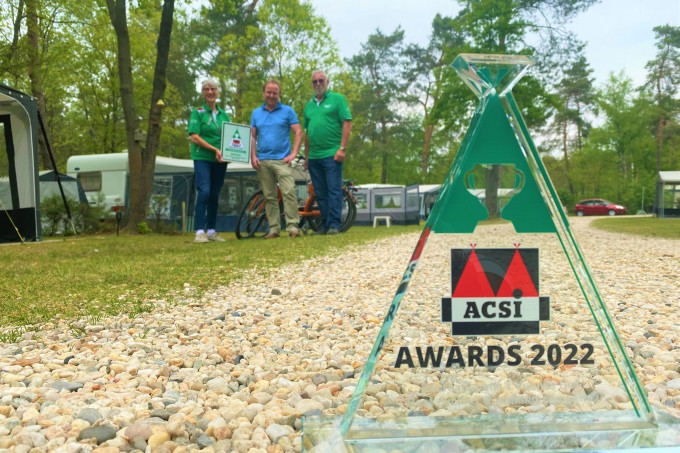
As the ACSI winner in the category of best cycling and walking campsite 2022, this page should not be missed. You will find everything here about the possibilities of the park and the surrounding area for walking, cycling and mountain biking.
Tip! Take binoculars with you, you might spot animals such as a boar, red deer, fox or perhaps a badger.
You will find much more information about walking and cycling routes on the Visit Veluwe website.
Versatile Veluwe | Visit Veluwe
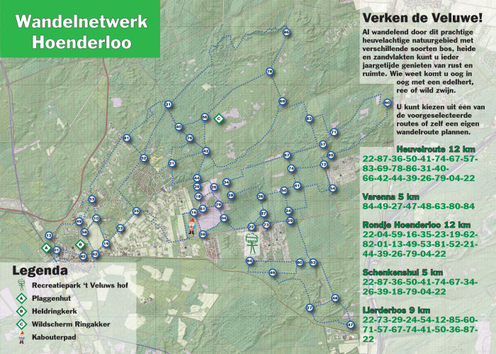
From the park you can walk straight into nature, there are various routes on winding paths that alternate between the forest and the heath. Of course, you can also walk freely and come up with your own route. The Hoenderloo walking network which you can see below can be downloaded but can also be picked up for free at the reception.
If you have a dog and want to let it run free, you can do so in the vicinity at the dog walking area 't Leesten (Navigation address: Het Leesten, Hoenderloseweg 191, 7339 GG Ugchelen). This area is 16 hectares and a fully fenced area followed by a 4 km wet nose route where dogs are also allowed to run free, provided that they are under roll call. For the other options, you can download the brochure of Staatsbosbeheer.
In general, you must keep your dog on a leash in the forest, there are exceptions, for which we refer you to the website of Staatsbosbeheer.
The possibilities in the heart of the Veluwe are surprisingly versatile, pedaling through the woods, along heaths and fens you will discover the great nature.
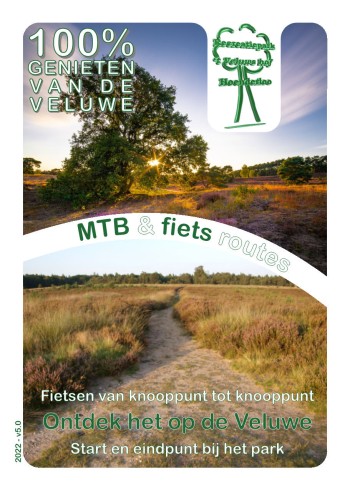
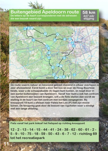
We give out a nice cycling booklet for free, from junction to junction, at the reception with routes from 14 to 60 km with which you can start directly from the park.
Via the Visit Veluwe route planner you can plan many more fun routes online, Plan your cycling route | Veluwe (visitveluwe.nl)
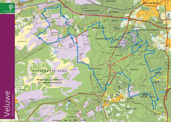
MTB Zandenwoud
Directly in front of the park runs the MTB Zandenwoud route of 52 km and 423 hm. The route is marked with the MTB symbol MTB symbol in black ![]() and takes you over nice winding single tracks interspersed with a few nice climbs and long wide paths.
and takes you over nice winding single tracks interspersed with a few nice climbs and long wide paths.
The area is characterized by vast forests and the beautiful heathland of Hoog Buurloo. The hilly area is home to many residents. For example, red deer, roe deer, wild boar, birds of prey and badgers roam around. The route runs (roughly) through 't Leesten, over Hoog Buurloo, Radio Kootwijk, Hoenderloo and Varenna.
If you turn right from the main entrance onto the cycle path, you will immediately start the route of loop A (22 km), loop A+B (37 km) or loop A+B+C (52 km).
The connecting routes / shortening routes are marked with a white MTB sign on a black background.
There is a GPS track file available, download it here. 
Or download the route folder below for an overview.
MTB National Park Veluwezoom
A little further from the park, about 4 km from the back of the park, is the Veluwezoom National Park route. This route has tough climbs, fast descents, technical trails and paths along the beautiful flora and fauna of the oldest National Park in the Netherlands. On the routes in Veluwezoom National Park, every mountain biker gets his money's worth in every season. To be able to ride on the MTB route in the Veluwezoom National Park, you must be in possession of an MTB vignette. This vignette is also valid on various other routes in the Netherlands. On the website of Natuurmonumenten you can see where this vignette can be bought and on which other routes you can cycle with it. Order your MTB vignette from Natuurmonumenten | Natuurmonumenten
You can recognize the mountain bike route by the blue MTB symbol ![]() .
.
This is an easy, varied nature trail, characterized by wider paths interspersed with singletrack. Distance and circumstances such as your own condition, the weather (loose or wet) and the season make this route of 49.9 km and 712 hm fast or more difficult.
![]() In addition, there are red extras.
In addition, there are red extras.
These trails are optional and can be recognized by the red MTB symbol. They always start and end on the blue main route and are characterized by more swings, s-turns and technical elements such as steep sections, obstacles or jumps. These are indicated by diamond signs: the number of diamonds indicates how technical and risky the element is. One diamond is risky, two diamonds is very risky and therefore only suitable for technically gifted mountain bikers.
![]() Abbreviations.
Abbreviations.
The route can be shortened in a number of places. This is indicated by a sign with a white triangle, in the color of the route.
For more information about this route, please visit the website of mtb-nationaalparkveluwezoom.
There is a GPS track file available, download it here.